Solo Female Hiking National Parks: Safety
Safety guide for solo female hikers in US National Parks. Trail selection, wildlife prep, gear essentials, and emergency protocols for women hiking alone.
This post may contain affiliate links. Disclosure
Solo Female Hiking National Parks: Safety
Updated for 2026 — Accurate as of February 2026.
I stood at the trailhead of the Narrows in Zion National Park at 6 AM on a Tuesday in October, completely alone. The canyon walls rose 2,000 feet on either side of the Virgin River, and I was about to walk 16 miles through them by myself. Every rational instinct told me this was dangerous. Every adventurous instinct told me it was exactly where I needed to be. I went. It was one of the best days of my life.
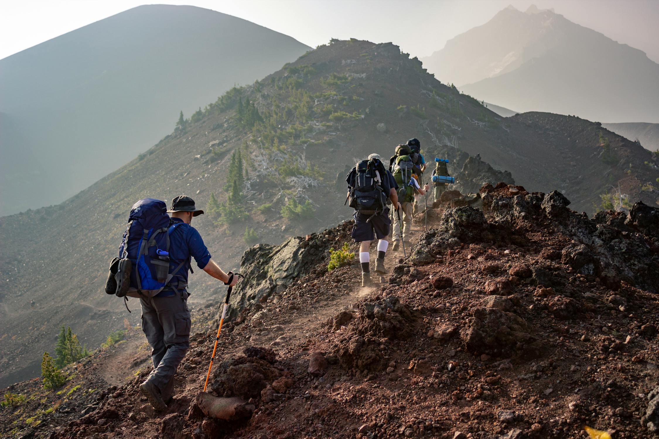
Solo hiking in National Parks as a woman occupies a strange cultural space. People admire it in the abstract and worry about it in the specific. “That’s so brave!” is always followed by “Aren’t you scared?” The answer is: sometimes. But fear is not the same as danger, and with the right preparation, solo hiking in National Parks is one of the safest and most rewarding adventures available to women.
The National Park Service reported 312 million recreation visits in 2025. Search and rescue operations numbered approximately 3,500 — meaning 99.999% of park visits went without incident requiring rescue. The parks are not inherently dangerous. They are, however, unforgiving of poor preparation.
Choosing Your Park and Trail
Difficulty Assessment for Solo Hikers
When you hike with a partner, you have a safety margin: someone to help if you twist an ankle, someone to flag down help if you cannot walk. Solo, you are your own safety margin, which means you should hike at a difficulty level below your maximum capability.
My solo hiking rule: I hike trails rated one level below what I would attempt with a partner. If I am comfortable with strenuous trails in a group, I solo hike moderate-to-strenuous trails. This gives me a buffer for the unexpected.
Trail difficulty factors to evaluate:
| Factor | Lower Risk | Higher Risk |
|---|---|---|
| Length | Under 10 miles | Over 15 miles |
| Elevation gain | Under 1,500 ft | Over 3,000 ft |
| Cell service | Available | No service |
| Trail traffic | Popular, well-trafficked | Remote, rarely hiked |
| Water crossings | None or bridged | Unbridged river crossings |
| Exposure | Shaded, forested | Exposed ridgelines, desert |
| Navigation | Well-marked, single path | Unmarked or multiple junctions |
| Wildlife | Low predator activity | Bear/mountain lion territory |
| Season | Peak season (more people) | Shoulder/off-season (fewer people) |
Best National Parks for Solo Female Hikers
Based on trail infrastructure, cell service availability, ranger presence, trail traffic levels, and overall safety profile:
Tier 1: Excellent for beginners and first-time solo hikers
- Acadia National Park, Maine: Compact park, well-marked trails, excellent cell service, ranger presence. The Beehive Trail and Jordan Pond Path are perfect entry points.
- Great Smoky Mountains, Tennessee/North Carolina: Most visited park in the system means you are rarely truly alone on popular trails. Excellent trail infrastructure.
- Shenandoah, Virginia: Skyline Drive provides road access to many trailheads, meaning help is never far away. The park is compact and well-patrolled.
Tier 2: Great for intermediate solo hikers
- Zion, Utah: The most popular trails (Angels Landing, The Narrows, Observation Point) are well-trafficked. Canyon terrain means trails are generally linear and hard to get lost on.
- Grand Canyon, Arizona: South Rim trails are well-maintained and heavily visited. Inner canyon trails are serious undertakings — solo hikers should have significant experience.
- Rocky Mountain, Colorado: Excellent trail system with varying difficulty. Altitude is the primary challenge — allow acclimation time.
- Glacier, Montana: Stunning scenery, bear country (carry spray and know how to use it). Going-to-the-Sun Road provides access to many trailheads.
Tier 3: For experienced solo hikers only
- Olympic, Washington: Remote backcountry, significant rainfall, and river crossings require experience and preparation.
- Denali, Alaska: No maintained trail system in the backcountry. Extreme terrain, wildlife, and weather. Solo hiking here requires expert-level skills.
- Gates of the Arctic, Alaska: The most remote park in the system. No roads, no trails, no cell service. This is genuine wilderness.
Essential Gear for Solo Female Hikers
The Non-Negotiable Gear List
Every item on this list has earned its place through personal experience or the experience of rescue professionals I have spoken with.
| Gear Item | Why It Is Essential | Recommended Product |
|---|---|---|
| Navigation (map + compass) | GPS devices fail. Phones die. Paper maps do not. | National Geographic Trails Illustrated maps |
| Satellite communicator | SOS capability when there is no cell service | Garmin inReach Mini 2 ($300 + $15/month) |
| Headlamp + spare batteries | If you are delayed and caught in darkness | Petzl Actik Core |
| First aid kit | Blister treatment, wound care, pain relief | Adventure Medical Kits Ultralight .7 |
| Emergency shelter | Hypothermia can occur even in summer at altitude | SOL Emergency Bivvy ($18, 3.8 oz) |
| Water treatment | Streams are not reliably safe | Sawyer Squeeze filter |
| Sun protection | Burns, heatstroke, and dehydration prevention | SPF 50+, sun hat, UV shirt |
| Bear spray | Required in bear country, effective against all threats | Counter Assault bear spray ($40) |
| Whistle | Sound carries farther than voice; three blasts = distress | Any pealess whistle |
| Fire starter | Warmth and signaling if stranded | Waterproof matches + lighter |
The Satellite Communicator: Your Most Important Purchase
If you buy one piece of gear for solo hiking, make it a satellite communicator with SOS capability. The Garmin inReach Mini 2 has been my most valuable piece of equipment across hundreds of solo miles.
What it does:
- Sends and receives text messages via satellite, anywhere on Earth
- SOS button contacts GEOS International Emergency Response Center 24/7
- Tracks your location and lets contacts follow your progress in real time
- Works where phones have zero service
The $300 device cost plus $15/month subscription is cheap compared to a single search and rescue operation (which averages $5,000-$50,000, and many parks will bill you if the rescue was necessitated by inadequate preparation).
Wildlife Safety
Bears
I have encountered bears on trails in Glacier, Great Smoky Mountains, Yellowstone, and Yosemite. Every encounter ended peacefully because I followed established protocols.
Prevention:
- Make noise while hiking — talking, clapping, or using bear bells
- Stay on trail and maintain awareness, especially around blind corners and near water
- Store food in bear canisters or use bear boxes at campsites (required in many parks)
- Never hike with headphones in both ears in bear country
If you encounter a bear:
| Bear Type | Behavior | Your Response |
|---|---|---|
| Black bear (most common) | Curious, generally timid | Make yourself large, speak firmly, back away slowly. If it attacks, fight back. |
| Grizzly bear | More aggressive when surprised | Stop moving. Speak calmly. Do NOT run. Back away slowly. If it charges, use bear spray at 20 feet. If contact occurs, play dead (face down, hands on neck). |
| Any bear near your food | Attempting to get food | Back away. Surrender the food if necessary. Report to rangers. |
Bear spray protocol:
- Carry it accessible — on your hip belt or chest strap, not in your pack
- Practice removing the safety and aiming (buy a practice canister)
- Deploy at 20-30 feet in a sweeping motion at the bear’s face
- It creates a cloud of capsaicin — move upwind after deployment
Mountain Lions
Mountain lion encounters are far rarer than bear encounters, but they do occur, particularly in western parks. Mountain lions are ambush predators, which means the attack you need to worry about is the one you do not see coming.
Prevention:
- Hike during daylight hours — mountain lions are most active at dawn and dusk
- Stay aware of your surroundings, especially on narrow trails with brush
- Make noise — mountain lions prefer to avoid humans
If you encounter a mountain lion:
- Do NOT run. Running triggers pursuit instinct.
- Make yourself large. Open your jacket wide, raise your arms.
- Maintain eye contact. Face the animal directly.
- Back away slowly. Give it an escape route.
- If it attacks, fight aggressively. Target the eyes and nose. Use rocks, sticks, trekking poles, anything.
Venomous Snakes
In desert parks (Big Bend, Joshua Tree, Grand Canyon, Zion) and some eastern parks (Great Smoky Mountains, Shenandoah), venomous snakes are present.
- Watch where you step and where you place your hands, especially on rocks
- Stay on established trails
- Wear over-the-ankle hiking boots
- If bitten: stay calm, remove jewelry and tight clothing near the bite, and get to medical care as quickly as possible. Do NOT apply a tourniquet, cut the wound, or try to suck out venom.
Weather and Environmental Hazards
Lightning
Lightning kills more people in National Parks than any animal. If you are above treeline (common in Rocky Mountain, Glacier, Grand Teton, and other alpine parks), you are a lightning target.
My rule: Be off exposed ridgelines and summits by noon. Afternoon thunderstorms in mountain parks are predictable — plan your hikes to summit early and descend before weather moves in.
If caught in lightning:
- Get below treeline immediately
- Avoid isolated trees, cliff edges, and bodies of water
- Assume the lightning position: crouch low on the balls of your feet, feet together, hands on knees, head down
- If hiking with trekking poles, lay them 50+ feet away from you
Heat-Related Illness
In desert parks (Grand Canyon, Death Valley, Joshua Tree, Big Bend), heat is the primary killer. The Grand Canyon alone averages 12 heat-related deaths per year.
Prevention:
- Carry and drink 1 liter of water per hour in extreme heat
- Supplement with electrolytes (not just water)
- Hike early morning or late afternoon, not midday
- Wear light-colored, loose, moisture-wicking clothing
- Know the signs of heat exhaustion (heavy sweating, weakness, nausea, dizziness) and heatstroke (hot dry skin, confusion, loss of consciousness)
Hypothermia
Yes, even in summer. Mountain weather is unpredictable, and being caught in rain at altitude can rapidly lower your body temperature.
- Carry a rain layer even on clear days
- Pack an emergency bivvy (weighs 3-4 ounces, could save your life)
- If you start shivering and cannot stop, seek shelter immediately, change out of wet clothing, and generate warmth through movement and insulation
Personal Safety on the Trail
The Human Element
I want to address the unspoken concern directly: as a solo female hiker, you may worry about encountering someone with bad intentions on the trail. This fear is understandable, and while violent crime in National Parks is extremely rare (less than 50 violent crimes per year across all 63 parks), it is not zero.
Practical measures:
- Tell someone your exact plans. Trailhead, route, expected return time. If you are overdue, they should contact the park.
- Register at the trailhead when a trail register is available.
- Trust your instincts about other people. If someone makes you uncomfortable, let them pass ahead and create distance. Change your plans if necessary.
- Carry bear spray. It is effective against human threats as well.
- Avoid sharing specific campsite locations with people you have just met on the trail.
- Hike popular trails when possible — there is safety in numbers.
Campsite Selection for Solo Women
If you are backcountry camping solo:
- Choose established campsites over remote ones when possible
- Set up camp where you can see approaching people/animals
- Keep your headlamp, whistle, bear spray, and shoes inside your tent
- If someone makes you uncomfortable, trust that feeling and move
- Cook and store food at least 200 feet from your tent (this also protects against bears)
Trip Planning Protocol
Before You Go
- Check current conditions: Call the park ranger station or check the park’s website for trail closures, wildlife activity, and weather forecasts
- File a trip plan: Leave a detailed itinerary with a trusted contact including trailhead parking location, planned route with waypoints, expected return time, and what to do if you are overdue
- Check in at the visitor center: Rangers can provide current trail conditions and let someone know you are on the trail
- Download offline maps: AllTrails Pro and Gaia GPS both offer downloadable offline maps with trail data
- Charge all devices: Phone at 100%, satellite communicator at 100%, headlamp batteries fresh
During the Hike
- Check the time against your pace regularly to avoid being caught out after dark
- Monitor weather changes — increasing clouds, dropping temperature, or wind shifts may signal incoming weather
- Eat and drink before you feel hungry or thirsty — by the time you feel it, you are already depleted
- Take photos of trail junctions and landmarks — they look different on the way back
- If conditions deteriorate or you feel unwell, turn around. The trail will be there another day.
Emergency Protocol
If something goes wrong:
- Stop and assess. Panic leads to bad decisions.
- If you can walk out, do so. Head back the way you came if unsure of the route forward.
- If you cannot walk out, activate your satellite communicator SOS. Stay put. Make yourself visible (bright clothing, emergency blanket reflects sunlight). Blow your whistle in sets of three.
- If you are lost, stay on trail if possible. If off-trail, stop moving and wait for rescue once you have activated SOS.
- Conserve energy and resources. Ration water and food if rescue may take time.
My Favorite Solo Hikes in National Parks
These are trails I have personally completed solo and recommend for their combination of beauty, safety, and accessibility:
| Trail | Park | Distance | Difficulty | Why I Love It |
|---|---|---|---|---|
| Delicate Arch | Arches, UT | 3 mi RT | Moderate | Iconic, well-trafficked, sunset is magical |
| Emerald Lake | Rocky Mountain, CO | 3.6 mi RT | Moderate | Alpine lakes, wildflowers, bear sightings (from a distance) |
| The Narrows (bottom-up) | Zion, UT | 6-10 mi RT | Strenuous | Walking through a river canyon — unlike anything else |
| Cascade Canyon | Grand Teton, WY | 9.1 mi RT | Moderate | Ferry ride to start, moose sightings, glacier views |
| Angels Landing | Zion, UT | 5.4 mi RT | Strenuous | Chain-assisted climb with breathtaking views (permit required) |
| Grinnell Glacier | Glacier, MT | 10.6 mi RT | Strenuous | One of the most beautiful hikes in the country |
| Highline Trail | Glacier, MT | 11.8 mi | Strenuous | Ridgeline hiking with mountain goats and wildflowers |
Every one of these trails taught me something about myself that I could not have learned anywhere else. The mountains have a way of stripping away the noise and leaving you with just yourself — your strength, your fears, your resilience. And discovering that you are enough, alone on a trail, is a gift that solo hiking gives you over and over again.
You Might Also Like
Get the best HerTripGuide tips in your inbox
Weekly guides, deals, and insider tips. No spam, unsubscribe anytime.